Langley Hall was an important place in the thirteenth century, home of the De Bereford family, statesmen who often had to travel. Bulls Lane and Ox Leys Road were their routes to Coleshill, Warwick, and London, while in the other direction their road to Sutton lay along Ox Leys Road, Reddicap Heath Road, Reddicap Hill and Coleshill Street. Traffic and weather wore away the surface of the road where it goes down the steep hill, which took the name Red Way from the colour of the sandstone defile, and the summit of the hill was the red way cop. The name, modified to Reddicap, eventually applied to a wider area.
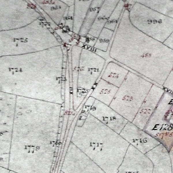
Most of the route between Langley and Red Way Cop consisted of a rough trackway across open commons and heathland. Parts of these commons were taken in for farmland over the centuries, so that by 1800 there were islands of common surrounded by fields, and one of these, a large traiangular area of common land to the east of Red Way Cop, became known as Reddicap Heath.
Zachariah Twamley (born 1780), writing in1855, recalled an old lady who lived on Reddicap Heath who told him about a murder. Edward Powers had been found guilty in August 1727 and hanged at Warwick; his body was sent to Sutton to be displayed on a gibbet near Fox Hill, and she had been in the crowd to see him “hung up”.
Cottages on the commons originated when a homeless person coming to Sutton claimed “squatters rights” by erecting a shelter on common land and spending a night there. Instead of evicting the squatter, as they were entitled to do, the Warden and Society would regularly fine him twopence, thus effectively receiving a rent but giving no security of tenure. Some squatters stayed on and improved their shacks to proper houses, and Twamley’s old lady who lived on Reddicap Heath lived in one such cottage.
The houses on the common, which often had small fields attached, were deemed to belong to the Warden and Society, and when the commons were enclosed, the ownership was confirmed. Such property belonged to the town’s charitable estates, but in 1885 Sutton received a new charter which did away with the Warden and Society and transferred the charitable estates to trustees. These trustees were known as Sutton Municipal Charities (now Sutton Coldfield Charitable Trust), a body which still owns some of the holdings claimed by squatters centuries ago.
(Article based Janet Jordan’s “History of Reddicap Heath”)