The Sutton Byway is a seven-and-a-half mile (12 kilometre) route through Sutton Coldfield’s Green Belt from Hillwood to Peddimore. An earlier version of the byway, known as the Rural Way, began at Hill Hook, and included the stretch of Hillwood Road from Sherifoot Lane to Manorial Farm. Hillwood Road is an Enclosure Road, laid out across the extensive Hill Commons in 1826 by the Enclosure Commissioner when Sutton’s common lands were enclosed.
Hillwood Road was enclosure road no. 30, described as commencing in the “road leading from Little Sutton to Hill Wood (Worcester Lane), extending in a northwardly direction over Hill Wood to or near to Kendrick’s Well and from thence in a westwardly direction over Hill Wood and Bradnocks Hayes and terminating at the east end of the Back Lane leading to Hill (Sherifoot Lane)”. The purpose of this road across the commons was rather to give access to existing properties than to provide a through route. Seventeen houses would otherwise have been cut off, most of them on the east side of the road near the Sherifoot Lane junction, but there were five cottages at the bottom of the hill at the place called Kendrick’s Well.
All seventeen of these properties originated as squatters’ holdings in the sixteenth and seventeenth centuries, established on the marginal common land which fringed Sherralls Field, one of the great medieval open fields pertaining to the village of Hill - the name “Sherifoot” is probably a corruption of “Sherrals Field” rather than a commemoration of a Sheriff who once resided at Kings Farm (at the junction with Hill Village Road, now an apartment block) as the late local historian Albert Fentiman believed.
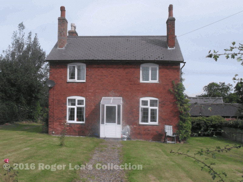
To the east and south of the newly laid out Hillwood Road the existing farmland was not far away, but there were very extensive commons to the north and west. The enclosure Commissioner divided the commons into fields known as allotment plots using a ruler and pencil on a map, so all these new fields are rectangular, and most of the new roads are straight. At the Sherifoot Lane end most of the allotments next to Hillwood Road were quite small - less than two acres - but further down the hill there were much larger ones, including plot no. 223 of forty-nine acres. This plot 223 along with some neighbouring ones was awarded to the Warden and Society of Sutton in recompense for the loss of manorial income which the enclosure had extinguished, and became known as The Manorial.
The Warden and Society laid out a farm at the Manorial, advertised for a tenant in 1832, and resolved on July 10th 1839 “That an advertisement be inserted in the next Birmingham Gazette and Midland Counties Herald requesting persons willing to contract for the erection of Buildings required by Mr Kempson at the Manorial to send in tenders for the 29th August”. Most of the other buildings on this north-west side of the road date from the twentieth century.
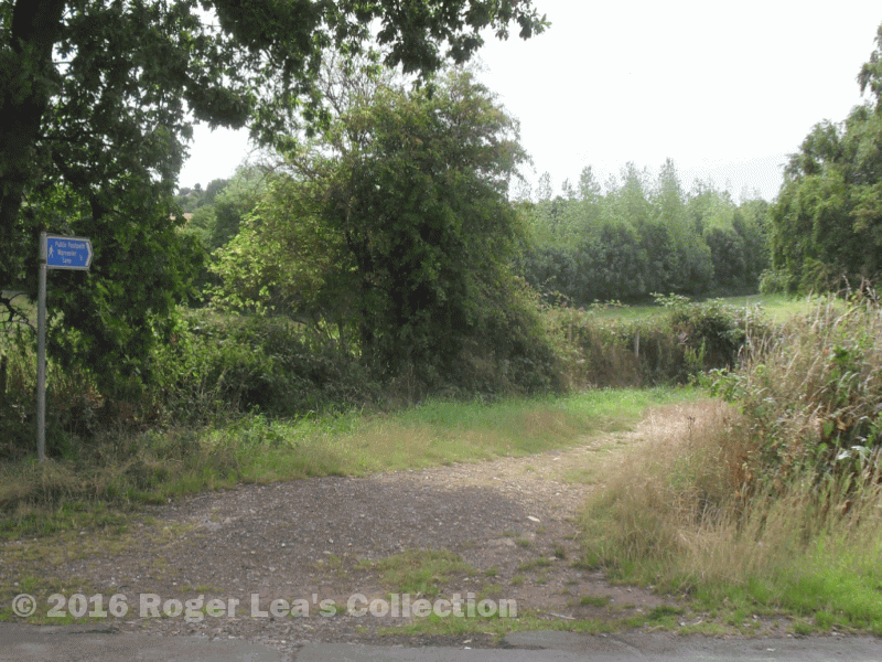
The track opposite Manorial Farm is the start of the Sutton Byway.