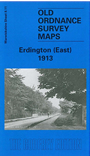
This detailed map covers the eastern part of Erdington, with coverage extending eastward to Pype Hayes Hall, and southward to Birches Green and Kingsbury Road. Features include a stretch of the Birmingham & Fazeley Canal with Nickel Works, Pype Hayes Hall and grounds, St Thomas & St Edmund's RC church, skating rink, Moor End Green, Rookery Park, Glenthorne, Birches Green Farm, Moat House, St Ethelreda's Mission church, tramway along High Street and Sutton Road, etc. On the reverse we include a selection of street directory entries, including Arthur Road, Church Road, Kingsbury Road, Mason Road, Orchard Road, Orphanage Road.
Alan Godfrey Old Ordnance Survey Maps of Erdington East (1913)
ISBN: 978-1-84151-686-8
£2.50
+ £2.40 p & p